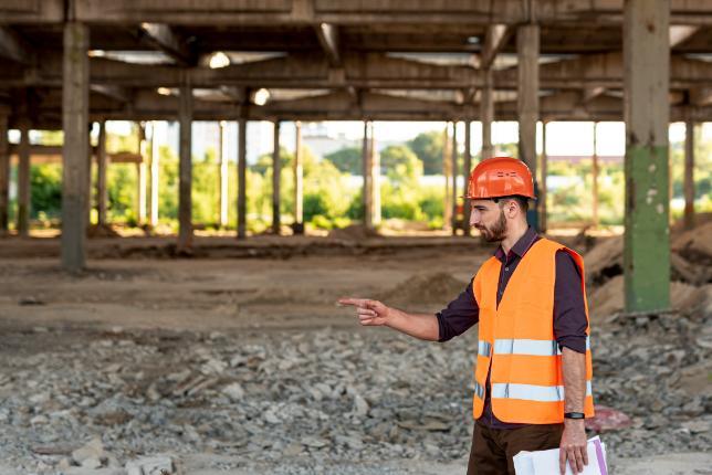
Flood Hazard Survey in Bristol
Enquire Today For A Free No Obligation Quote
At Flood Hazard Survey, we provide accurate and fully compliant flood risk reports for properties and development sites in Bristol and across the UK.
Whether you are submitting a planning application, purchasing a plot, or protecting an existing building, our surveys assess the level of flood hazard and recommend effective mitigation measures.
Flood Hazard Survey combine detailed local expertise with national standards to ensure your report meets the expectations of planning authorities, the Environment Agency, and potential investors.
Why Is a Flood Hazard Survey Required in Bristol?
A flood hazard survey in Bristol is often a legal requirement for developments situated in or near designated flood zones, or in areas with limited drainage capacity.
This report helps planning authorities understand how a proposed development will manage potential flood hazards in Bristol without negatively impacting surrounding properties, ensuring both safety and compliance.
Which Types of Developments in Bristol Require a Flood Hazard Survey Report?
We prepare flood hazard survey reports in Bristol for a variety of developments where planning rules require them, including:
- Developments within Flood Zones 2 or 3 – Locations with a higher risk of river or coastal flooding.
- Sites larger than one hectare – Regardless of official flood zone classification.
- Projects near rivers, reservoirs, or the coast – Where proximity to water increases flood hazard potential.
- Sites with a record of surface water flooding – Even if outside mapped flood zones.
- Developments where the local planning authority mandates a survey – As part of planning approval conditions.
How Much Does a Flood Hazard Survey Cost in or Around Bristol?
The cost of a flood hazard survey in Bristol ranges from £500 to over £2,000, depending on the size of the site, its flood zone classification, and the complexity of the analysis.
Costs are influenced by the need for hydraulic modelling, the availability of historic flood data, drainage capacity assessments, and any additional inspections or mitigation recommendations.
Contact Flood Hazard Survey in Bristol to receive a customised quote for your property.
How Do Flood Hazard Surveyors in Bristol Assess Risk Levels?
Our flood hazard surveyors in Bristol use Environment Agency data, local authority records, and on-site inspections to produce accurate assessments.
We analyse ground elevations, drainage systems, and hydrological patterns to understand how water could behave on-site during severe weather events. When required, advanced hydraulic modelling is applied to simulate realistic flood scenarios in Bristol and pinpoint areas of vulnerability.
Are Flood Hazard Surveys in Bristol Required for Planning Applications?
In many areas of Bristol, a flood hazard survey is a mandatory requirement for planning applications—particularly for developments in identified flood zones or those with drainage concerns.
Submitting a compliant, well-structured report can increase the likelihood of approval by showing that flood hazards will be managed effectively.
Can a Flood Hazard Survey in Bristol Recommend Mitigation Measures?
Our flood hazard surveys in Bristol not only assess the level of risk but also include practical recommendations to reduce it, such as raising finished floor levels, installing flood defences, improving drainage systems, or incorporating sustainable drainage solutions (SuDS).
These measures help meet planning conditions and protect the development in the long term.
How Long Does It Take to Complete a Flood Hazard Survey in Bristol?
For most residential properties, a flood hazard survey in Bristol can be completed within one to two weeks.
Larger or more complex developments in Bristol requiring detailed hydraulic modelling may take longer. We work to agreed timelines to support smooth planning processes.
What Information Is Included in a Flood Hazard Survey Report for the Bristol Area?
A typical flood hazard survey for a Bristol site includes:
- Flood zone mapping – Showing the site’s classification within Environment Agency flood categories.
- Historic flood records – Reviewing past flooding incidents and their local impacts.
- Topographical analysis – Assessing ground gradients and levels to predict water flow.
- Identification of potential flood sources – Including rivers, tidal waters, groundwater, and surface water run-off.
- Flood modelling – Simulating potential flood depths and flow velocities for multiple return periods.
- Drainage capacity assessment – Analysing the performance of existing systems under rainfall events.
- Mitigation recommendations – Providing strategies to reduce any residual flood hazard.
Do Flood Hazard Survey Reports in Bristol Meet Regulatory Standards?
All our flood hazard survey reports in Bristol are prepared in line with Environment Agency standing advice, Planning Policy Statement (PPS25) guidance, and relevant local authority requirements. This ensures they meet all technical and compliance standards for approval by regulatory bodies.
Contact Flood Hazard Survey in Bristol today to arrange your assessment.
Find More Info
Make sure you contact us today for a number of great flood hazard survey services in Bristol.
For more information on flood hazard Survey in Bristol , fill in the contact form below to receive a free quote today.
★★★★★
“Flood Hazard Survey delivered a highly detailed and fully compliant report for our development in Suffolk. Their expert team combined thorough local knowledge with clear mitigation advice, which was crucial in securing planning approval. I found their communication excellent throughout the process.”
Beatrix Wainwright
Bristol
★★★★★
“We commissioned Flood Hazard Survey to assess flood risks for a property purchase in Herefordshire. Their comprehensive analysis and practical recommendations gave us confidence in managing potential flood hazards. The professionalism and attention to detail were outstanding.”
Edmund Carleton
Bristol